drone tech · construction & infrastructure

Construction & infrastructure, from the air

A drone venture case applying drone surveying to construction and infrastructure — work-progress documentation, earthworks (cut-and-fill), 3D models, and linear works like roads and pipelines.

Below: real deck pages (Spanish), as they were.
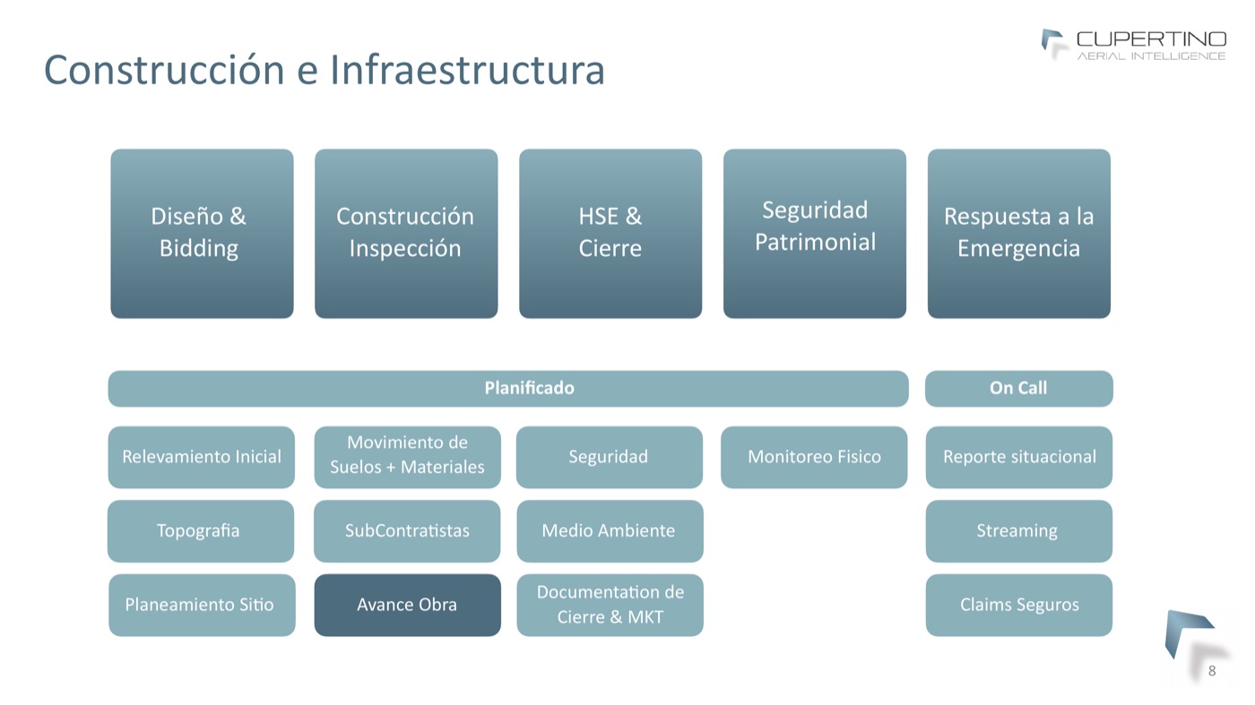
Construction and infrastructure solution lines
Solution lines — design & ranking, inspection, progress & closure, asset security, emergency response.
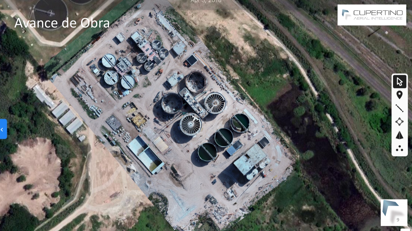
Construction work progress from the air
Work progress — a construction site documented from the air, period over period.
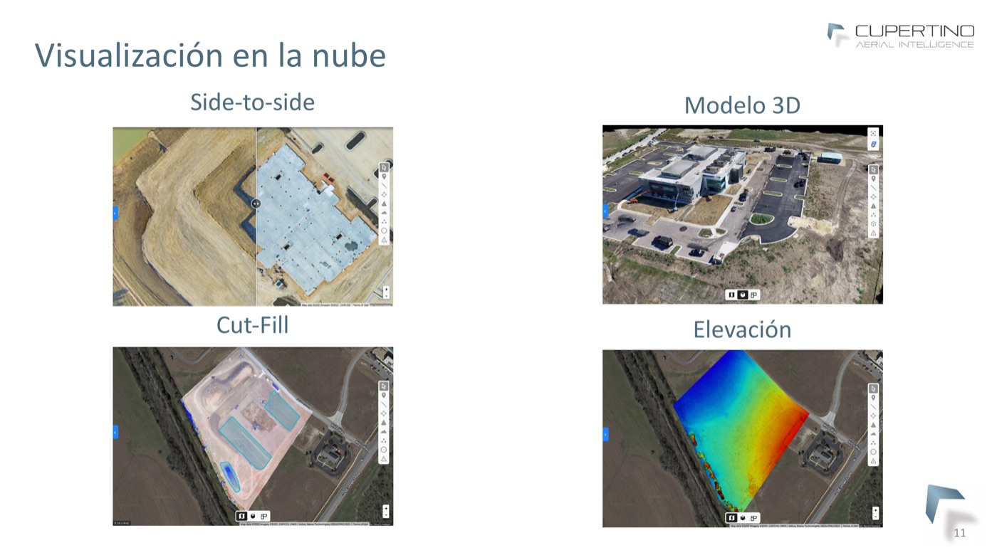
Cloud deliverables — side-by-side, 3D model, cut-fill, elevation
Cloud deliverables — side-by-side comparison, 3D model, cut-and-fill earthworks, elevation.
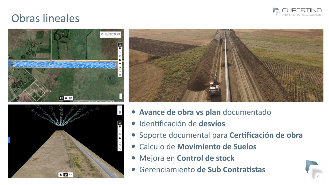
Linear works — roads and pipelines
Linear works — roads and pipelines surveyed end to end; earthworks progress, soil-movement certification, contractor oversight.
→ Back to drone venture ← Back to home