drone tech · oil & gas · 2022

Refinery — infrastructure survey from the air

A drone venture case: an aerial infrastructure survey of a refinery. We documented the site — orthomosaics, 3D models, measurements, a flagged-issue report, and a risk-tiered map of every building — without sending anyone up on the roofs.

Below: real deliverable pages (Spanish), as they were.
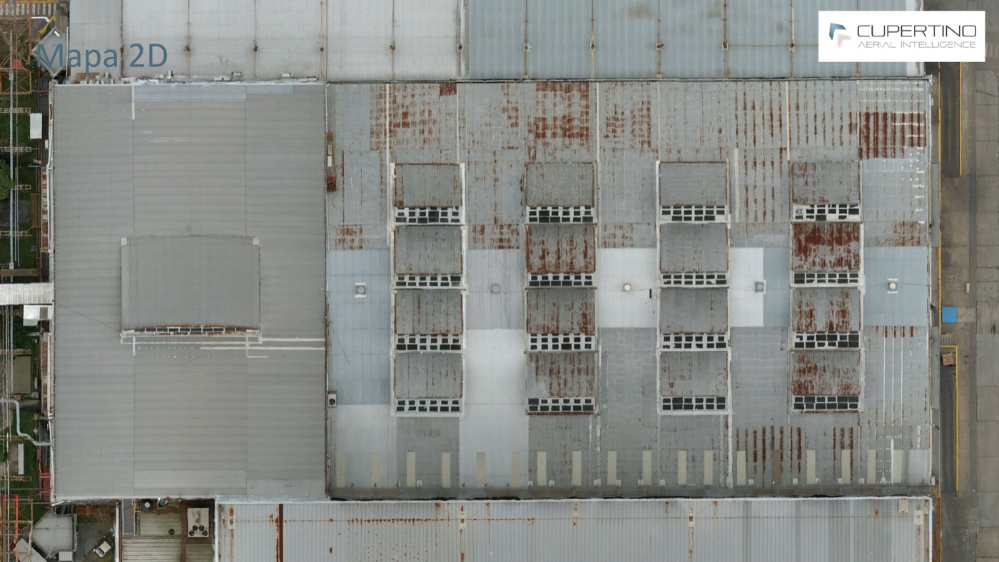
2D orthomosaic of the refinery roofs
2D map — a high-resolution orthomosaic of the facility roofs, every panel and skylight in place.
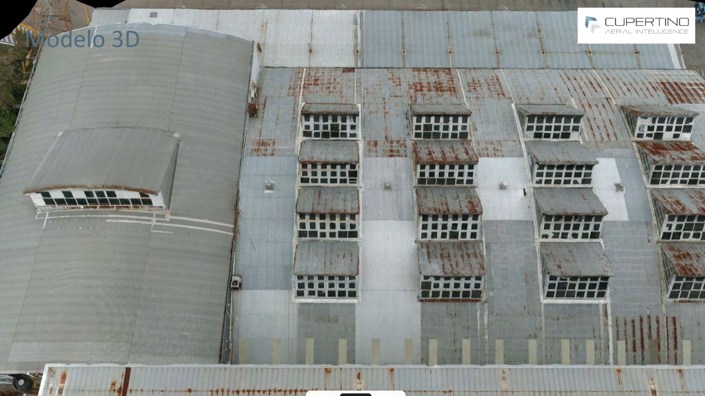
3D model of the facility structures
3D model — the same structures reconstructed in three dimensions.
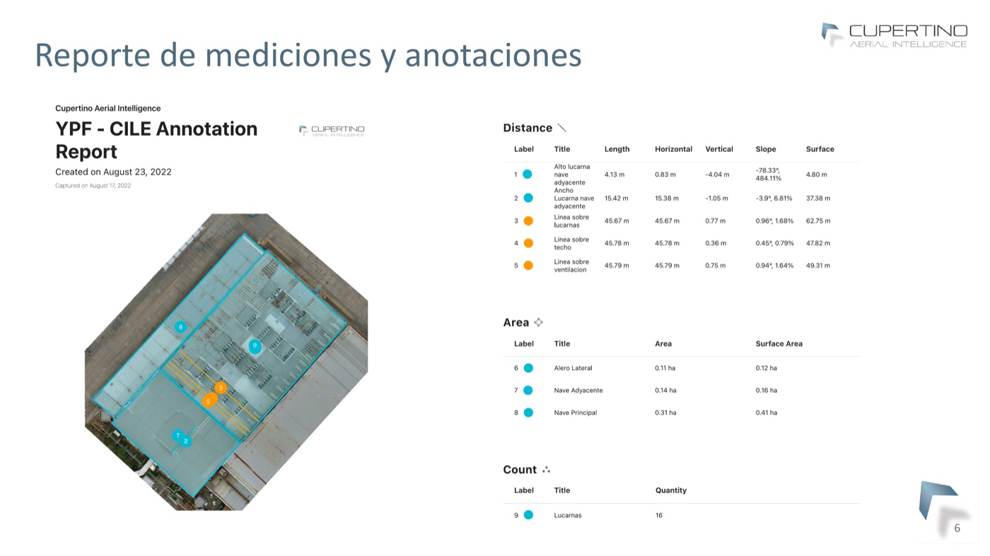
Measurement and annotation report
Measurement & annotation report — distances, areas and counts (skylights, naves, surfaces) taken straight from the imagery.
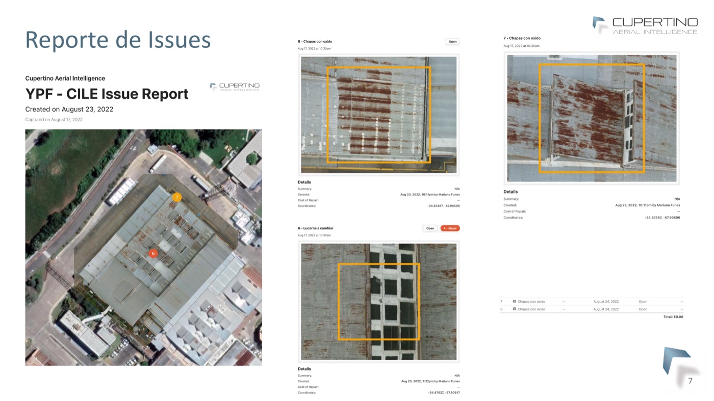
Issue report flagging rust and damage
Issue report — corrosion and damage flagged with severity and coordinates, ready to feed maintenance planning.
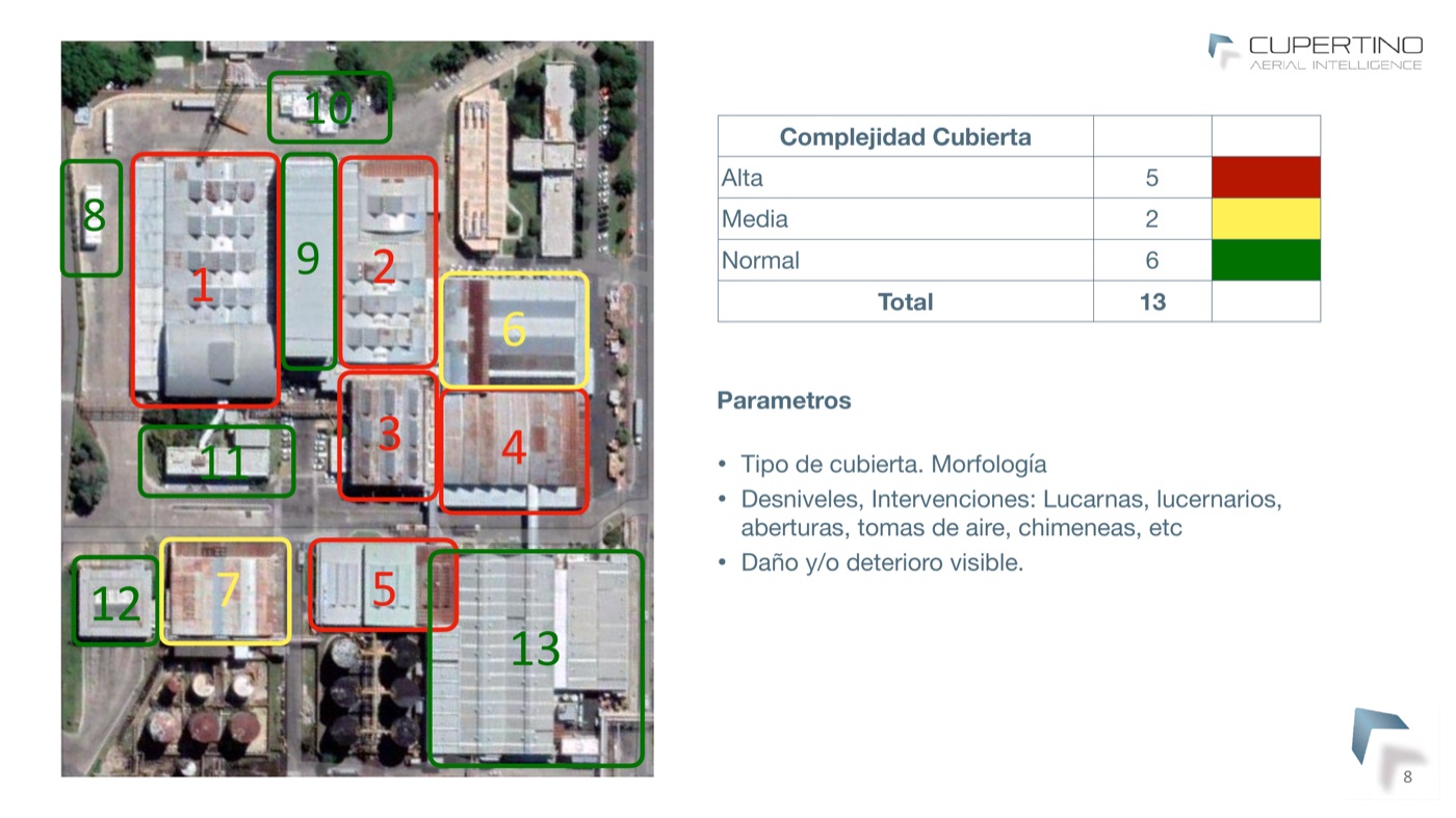
Site map of 13 buildings triaged by roof complexity
Site overview — 13 buildings triaged by roof complexity (red / yellow / green) to scope and prioritize the work.
→ Back to drone venture ← Back to home